

Asset management is a complex task that requires large amounts of information of many different types. Utility and energy management, maintenance management, space management, tenant management, environmental compliance, and many other factors are all important in the operations of asset managers. However, this information is typically spread across many different computer systems, which can make the work of asset management more tedious, error-prone, and costly. In order to improve the efficiency and effectiveness of asset management, it is important to find ways to integrate this information and use it in a more comprehensive manner throughout the life cycle of a building.
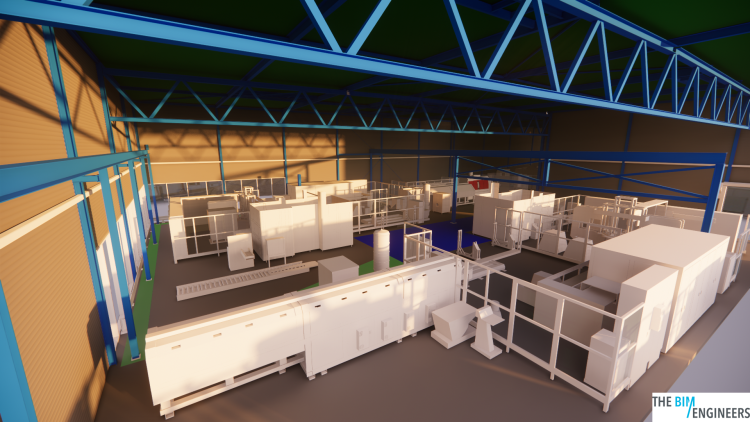
Building Information Modeling (BIM) is a powerful tool that is increasingly being used by architects and other building professionals to improve the design and construction of buildings. BIM allows architects to create detailed 3D models of buildings that can be used to improve communication and collaboration among the many different stakeholders involved in a building project. Additionally, BIM allows architects to create a detailed digital record of a building that can be used for facilities management and other purposes throughout the life of the building.
The benefits of using BIM during building design have been well-publicized and are fueling its adoption rate among architects worldwide. BIM is transforming the traditional drawing-based processes of architects to model-based processes, which allows for more accurate and efficient communication and collaboration among the many stakeholders involved in building projects. Furthermore, the benefits of using information from a building model for facilities management are likewise compelling, fueling the discussion surrounding building lifecycle management and nudging facilities management towards model-based processes.
Geographic Information Systems (GIS) is another powerful tool that can be used to improve asset management. GIS can facilitate data collection, processing, and display and can also integrate asset mapping with project management and budgeting tools so maintenance, inspections, and expenses can be accounted for in the same place. GIS can also help with predictive maintenance by assisting in the locating of problems and the scheduling of work, as well as in locating and fixing poorly performing assets.
Despite its many benefits, GIS is not yet widely used in the asset management industry. Many asset managers are not aware of the benefits that GIS can bring to their operations, and there is a lack of understanding of how GIS can be integrated with other tools such as BIM to improve overall efficiency and effectiveness.
In order to improve the efficiency and effectiveness of asset management, it is important to find ways to integrate data from different sources and use it in a more comprehensive manner. This is where the integration of BIM and GIS can be particularly powerful. By combining the detailed 3D models of buildings created with BIM with the detailed geographic information provided by GIS, asset managers can gain a much more complete and accurate picture of the assets they are managing. This can allow them to make better-informed decisions and to more effectively plan and budget for maintenance and other activities.
In conclusion, data integration is important for effective asset management. Many IT tools could facilitate such a process, but in particular, GIS and BIM. Geospatial information is important for effective large-scale asset management, as a large percentage of data used by the asset managers to answer their key questions is geographical. Geospatial location could be used as an approach to integrate various data sets. One single geospatial reference system, a simple geo-coded marker, may act as a unique identifier reconciling geographic, building, demographic, and economic information.
Copyright © 2024 The BIM Engineers. All Rights Reserved | Design & Developed by Prettify Creative